A trekking of two days through the Andringitra National Park (Madagascar) and a climb of Pic Boby (2658 m) |
|
|
|
|
||
by Fred Triep
(translation of the Dutch page by Fred Triep)
|
 |
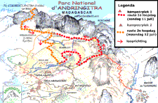
The map on the left is The perspective
map
on the Click on
the map on the |
This map is a manipulation |
![]()
The Andringitra massive is one of the highest mountain chains
of Madagascar. The chain of this mountains runs in the central highland south of
the village Ambalavao. The approximately 30 km long chain runs northwest till southeast and consist of granite.
The massive is, on behalf of his scenic beauty and the appearance of many endemic
species of plants, since 1999 part of a new National
Park (Andringitra National Park). The paths in this park are maintained in a
very good state. On difficult patches of the paths one has created
solutions, so everyone who is fit can make the hike. Some steps were also made
with big flat stones (for example in the stretch to the Pic Boby and near the first
cascade).
In this area of mountains one can distinguish 3 levels:
1. The high massive chain (Ampianombilahy) above 2100
meter, with as highest mountain the Pic Boby.
2. The tableland (Andohariana plateau) on approximately1900 till 2100 meter
height.
3. The low river valley on approximately 1500 till 1600 meter height.
I havw made this trekking with Marianne v. R. in July 2004.
This trekking was parts of a seven weeks journey through Madagascar.
As in other National Parks in Madagascar, you can only make guided trips in the
park. The guides are provided by the organization of the national parks (ANGAP).
We organized the whole trip with Santostrekking: the transport to and from the Park (from Fianarantsoa and after the trekking
back to Ambalavao), the porters, the food and the selection of the accompanied
guide. During the trekking, that takes
two days, our luggage and my tent were carried by two porters.
One can camp on a limited amount of places in the National Park. We have camped
on the following places:
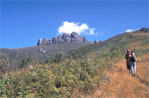
On Saturday 10 July 2004 we were picked up at10.30 by Santos (of Santostrekking) at the hotel Moderne in Fianarantsoa. We drove with a car at first to Ambalavao, where we leaved some luggage, which we did not need for the trekking. After that we drove to the entrance on the east side of the Park, where we paid the entrance fee and we got Martin as our guide assigned.
 |
The large picture is 70 Kb
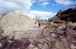
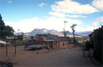
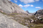
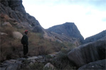
Links: View on the Andringitra massive from the last village before the mountains Photo: Fred Triep |
We hiked with our guide in the afternoon to our first camp site, while Santos and the driver brought the car to the car park near our first camping site.
Sunday 11 July
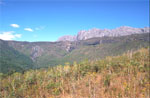
During our breakfast we could look out from our campsite on the Andringitra massive.
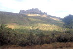 |
The large picture is 86 Kb Left: View on the Andringitra massive from our first campsite Photo: Fred Triep |
We hiked from our campsite the path through the wood to
the river.
We followed the path to a little view, from where we looked out on the valley
and the river. After that we we creep through a low cave (Tjajofo cave), where after
we descend on a path.
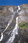
After we hiked along the foot of the "male" cascade (Riambavy, a 250 m
high waterfall).
 |
 |
The large pictures are
respectively 131 Kb, 161 Kb and 128 Kb Totally
left: We hiked along the bottom of the "male" cascade (Rianbavy) Photos: Fred Triep |
 |
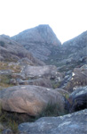
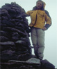
The path runt along the slope on the other side of the valley. We passed after some time the "female" cascade (Riandahy, a 300 m high waterfall). After that we arrived at a bifurcation. We did not follow the path down (that was running to our first camp site), but a path up. That path was reasonable steep aloft, we leaved the wood and we could see very well the big granite tops of the mountain massive.
 |
The large pictures are respectively
110 Kb en 122 Kb
Left: We climb on a steep path aloft to the
Andohariana plateau Photos: Fred Triep |
 |
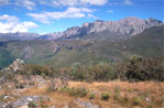
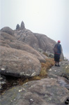
After some time we reached the Andohariana plateau. There we enjoyed just of the
view over the edge of the plateau. At the same time we ate the lunch, which consist
of rolls with omelets and vegetables.
Then we climbed further up to the right around one of the granite mountain tops.
We
came on a higher plateau behind these tops.
 |
 |
The large pictures are
respectively 119 Kb, 110 Kb en 130 Kb Totally
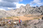
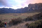
left: From the rim of the plateau we look out on the valley, the plateau
(Andohariana) and the granite tops Photos: Fred Triep |
 |
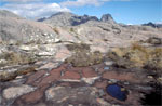
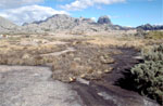
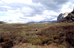
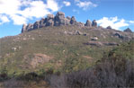
On this tableland, which was scarcely overgrown because of the height, we hiked without following a discrete path. We hiked to the pass between two mountaintops, by which we arrived on a plateau with tops to the right and the edge of the plateau on the left.
|
|
The
large pictures are respectively 121 Kb, 121 Kb, 126 Kb, 125 Kb and 102 Kb Above
left, above right, below left and below right: Impressions of
the Andohariana plateau (around 2000 m height) Photos : Fred Triep |
|
|
|
|
|
|
At the end of the afternoon, we reached our second campsite.
 |
The large pictures are
respectively 188 Kb en 75 Kb
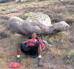
Left: Our guide Martin has become Napoleon! Photos: Fred Triep |
 |
Santos had set up
our tent together with the porters.:
Duration of hiking: 8 hours and 30 minutes (it can quicker, but we hiked slowly because we looked
at many plants)
Monday 12 July
At half past four I was waked by my alarm clock. Martin and I should start at five o'clock with our climb to the Pic Boby. Marianne had decided the evening before, that she didn't want to make the hike to the summit. She wanted to spare her knees. When I was ready on five o'clock, Martin was still sleeping. I waked him and at 5.45 am we leaved the camp. We crossed the river behind the campsite and we followed in the dark a path, that run along the slope aloft. On our way up, it became twilight.
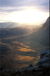 |
The large picture is 113 Kb Left: During our climb to the Pic Boby the sun rises Photo: Fred Triep |
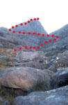
During some time we followed a path, that bent to the right en runt upwards between granite tops, We reached a basin between the mountains, with in front of us Pic Boby.
 |
The large
pictures are respectively 117 and 141 Kb
Left and right: Finally we had a view
on Pic Boby Photos: Fred Triep |
 |
 |
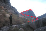 |
Then we followed a route on big naked stones, first to the left and after some time more to the right and upwards.
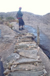 |
The large pictures are
respectively 157 Kb and 148 Kb Left: A
large stone has been made hike able by steps of small stones Photos: Fred Triep |
 |
The hiking route was distinctly marked by means of "stone men". At 8 o'clock we were on the summit of Pic Boby (2658 m).
 |
The large picture is 78 Kb
Links: Fred Triep is on the summit of Pic Boby next of a large "stone man" Photo: Martin |
When we arrived at the summit, there was bad visibility. It was also very windy, it was very unpleasant to stay there for a long time. Therefore we decided at 8.10 am to descend. We returned slowly to our camp, where we arrived at 10 o'clock. We ate some food and drunk some tea and coffee.
| Pic Boby is the second mountain top
of Madagascar. It is easy to climb, you can hike the whole
way to the summit (with only a few difficult steps). The highest
mountain of Madagascar is the 2876 meter high Maromokotro, which lies in the Tsaratanana
massive in the north of Madagascar. That mountain is very difficult to
climb. Pic Boby has always had a Malagasian name, namely Imarivolanitra. The French name of the mountain is coming from a dog. A botanist camped in 1920 with his dog Boby below the summit. Some night it was very foggy and when Boby went to stroll, he lost possibly his way. The investigator heard his dog bark in the fog and he tried to find the dog. By that he reached the summit of this mountain. It is not noted, if he ever found again his dog.. |
At 11.00 am we (Marianne, Martin and I) hiked back to below. We
now followed the shortest route, a path that crossed the tableland
and that without being perceived through the wood runt down. Approximately
at 14.00 am we reached again the river near our first campsite. We took
a lunch and bathed our feet in the river. After that we hiked to the cars on
the parking place in front of the park. In about two hours we drove back to Ambalavao.
Duration of hiking: 4 hours and 15 minutes (there and back from Pic Boby) + 3
hours (descend to the exit of the park)
There are a few trekking- agencies, who can organize a trekking of one day or two days or more days by which also the transport, the food, the camping equipment and the porters can be arranged.
1. Santostrekking
Santos Gerald
tel: + 261 33 08 44 360
e-mail: santostrekkingmadagascar@gmail.com
We had good experiences with this trekking agency.
2. Lolo Voyages
BP 1183, Ambalapaiso- Ambony, Fianar
Martine Drie
+ 261 20 32 25 200 76
e-mail:
lumpalumpa@freenet.org
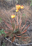
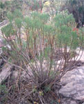
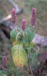
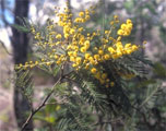
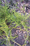
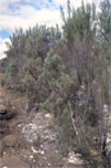
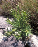
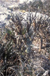
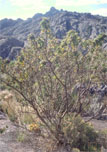
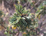
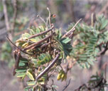
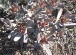
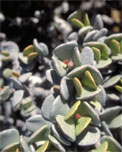
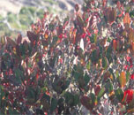
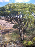
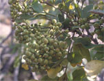
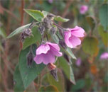
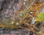
The pictures below give an impression of the plants, we found along our trip.
Plants in the valley |
|||
|
|
|
|
|
|
|
|
|
|
The first five plants in the table above were found on the
first day, when we hiked below the tableland. The sixth plant we came across at
the the descent at the end of the second day.
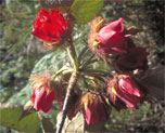
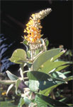
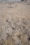
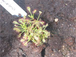
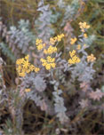
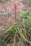
The plants in the table below were
found on the tableland and at the descent of Pic Boby to the Andohariana
plateau.
Plants on the Andohariana plateau |
|||
|
|
|
|
|
|
|
|
|
|
|
|
|
|
|
|
|
|
|
|
|
|
|
|
|
Hilary Bradt
Madagascar
Bradt Travel Guide, zevende druk, 2002
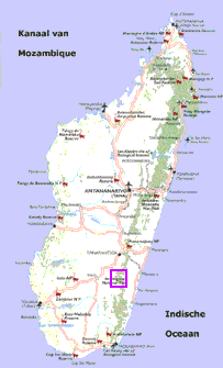
At the FTM (Institut National de
Géodésie et Cartographie) in Antananarivo we could only buy a photographical
map on a scale of 1: 100.000. I had not bought that map, because he was very
indistinct.
At the entrance of the park you can buy a separate flyer with a simple
perspective map of the mountain chain, on which the different hiking routes have
been drawed.
During the trek I have made 29 waypoints on my Garmin E Map. You can view a detailed map with these waypoints, if you click on the small map below (left). In the table to the right the information about the waypoints are presented.
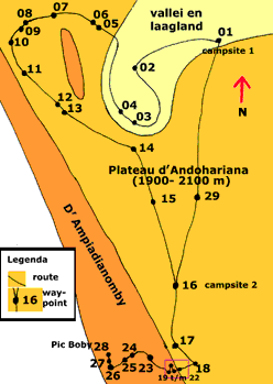 |
|
- This part will be supplied in the future!
This page has been last updated on Sunday 18 May 2008.
![]()
For additions or reactions, you can e-mail me:
![]() email : Fred Triep
email : Fred Triep